Aerial LiDAR and Photogrammetry
We offer fully ground-referenced, high-resolution aerial LiDAR and photogrammetry for surveying, earthworks, development, and land management.
Key benefits
Sub-centimetre accuracy with ground control for reliable topo and surface models
Rapid data acquisition across large or difficult sites
High-density point clouds and orthophotos for precise measurements and mapping
Digital elevation models (DEMs), digital surface models (DSMs), and detailed terrain contours
Vegetation and feature classification for asset and land-use analysis
Integration-ready outputs for CAD, GIS, and earthworks software
Typical Applications

Volume Measurements
Cut and fill for earthworks quantification
On site material and material cost quantification
Tailing or stockpile volume calculations
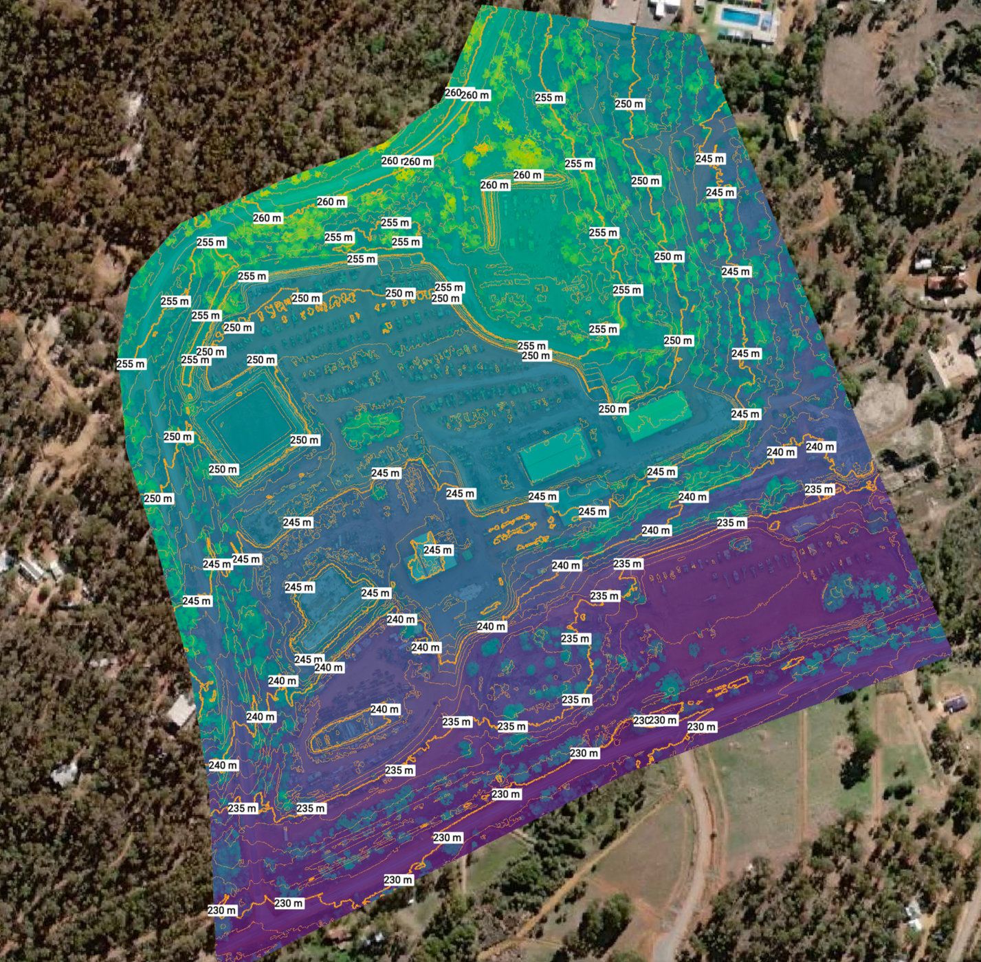
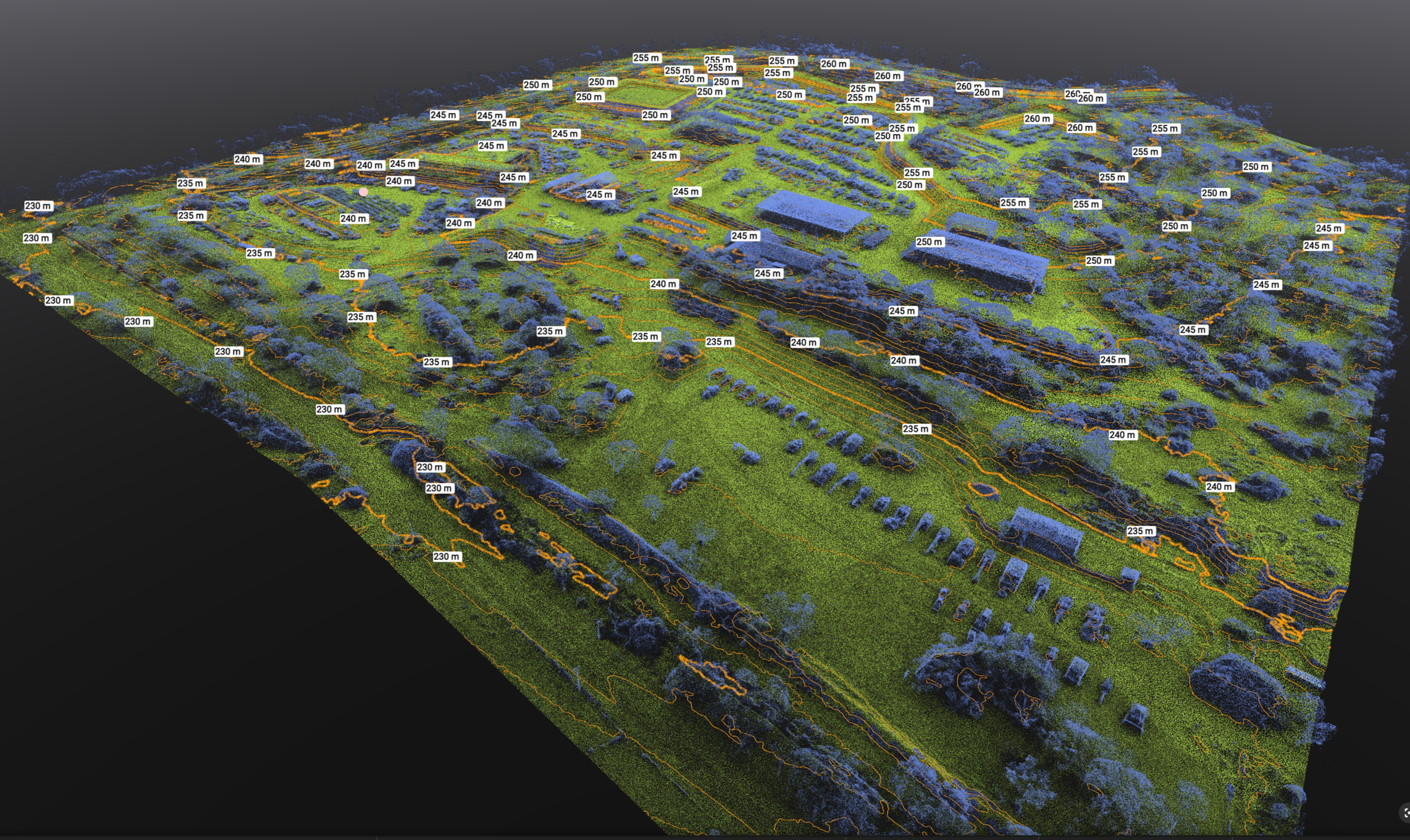
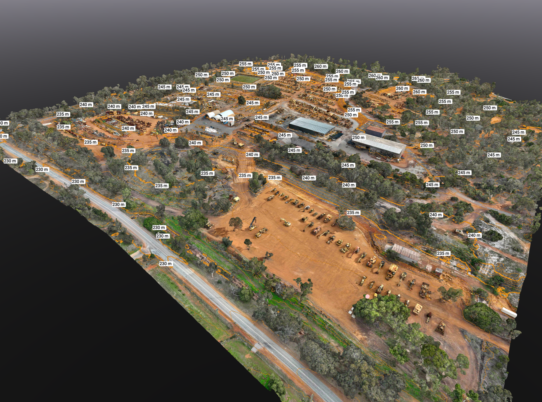
Topo Models
Hi resolutions topographical models including graphical map outputs
Development planning
Drainage and forresty planning
Typical deliverables
Ground-referenced point clouds (LAS/LAZ)
Orthomosaic imagery (georeferenced)
DEM/DSM and hillshade rasters
Breaklines and contour files
Feature extraction and classification reports
Site volume calculations and change-detection comparisons
3D Model
Digital twin of assets
Asset change over time
Project planning and development
Applications
Boundary and topographic surveying
Cut-and-fill and earthwork quantification
Site development planning and construction monitoring
Flood risk and drainage modelling
Forestry and vegetation management
Infrastructure inspection and corridor mapping
Why choose us?
Tailored data collection plans matched to project requirements
Experienced survey-grade workflows and quality control
Deliverables formatted for seamless integration into your existing systems
Fast turnaround and responsive technical support
Let’s Work Together
Contact Cohen below: